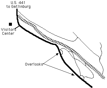

Quiet Walkway parallels the river adjacent to the road from the Visitors' Center to Newfound Gap. The Sugarlands Road parallels the opposite side of the river. Quite a number of dwelling places evidently adorned this narrow bottomland. Numerous fords and demolished bridges connect the two trails.
There are three entry ways to the quiet walkways. Two pull-offs to the left of U.S. 441 mark the entrance to them just beyond the visitors center (leaving Gatlinburg). At the second walkway entrance, a gravelled path to the right and a dirt path to the left will be found. We chose the dirt. This follows rhododendron through a valley along an old road. The gravelled path is wide enough for a limousine and passes a hidden cemetery on the right. Poplar are dominant at first, turning to box elder and other maples, plus many, many other hardwoods plus pine and hemlock. The cemetery is found by searching for a small path leading to the right (on the way in) into a notably younger forest. Continuing on, the gravel eventually turns to a dirt (or mud as the case with us). A wide clearing offers a small stand of willow to the right and pawpaw to the left. Dominant trees along the creek are birch, beech and sycamore. As these trails are numerous, I include a rough map (guaranteed not to be to scale) of the trails. I should include the points of interest, but I forgot. Sorry, you must discover them yourself!
The Old Sugarlands Road starts across the street from the entry to the Park Headquarters immediately before the visitors center (again, leaving Gatlinburg). It basically follows the river in a straight line. A couple of trails to the Roaring Fork Motor Nature Trail branch off to the left. Continuing straight, the road is very broad and obviously runs through the remains of a once-bustling community. At the end of the road a jeepable trail intersects from the left, leading to Cherokee Orchard. Actually, the road continues on for quite a ways further, eventually branching to the right and left.
We hopped rocks in the creek. Although in my opinion, this is not the best place for this. I recommend the Chimney's parking area for rock hopping. This creek is very nice for sitting, listening and watching. I cannot explain why this is my opinion, maybe you won't agree. Informational Flash - at every location in the park, rock hopping must be deemed dangerous. NEVER - EVER EVER EVER jump onto a rock which is not completely dry. (This is officially a lecture.) You will almost certainly break your leg. Never put your weight onto a submerged rock until it has been tested not to slip. If you have ever been told that greased pigs are slippery, wet rocks are far more slippery: dry rocks on wet feet or shoes are almost as bad. My recommendation is to go barefoot, as you have much better toe grip as well as feel of the slipperiness of the rocks. Hopping is great fun, but not if it means a trip to the hospital. One last caution, rushing water can knock you off your feet even when it is less than a foot deep - GO SLOWLY!
The Quiet Walkway paths overlooks the creek for about a mile-long stretch. A concrete bridge embuttment is obvious on the far side, now torn down. It will take more careful searching to locate a second bridge. We found it from the opposite side. I would like to know more about this old town. You should consider hiking the sister trail the Old Sugarlands Road. It is intriguing to think about the families and property of those dispossessed half a century ago. Answer questions, like "Where did the Huskey Gap trail cross the river?" (I think it was at the second bridge mentioned above.) What was the population here? Why is a quite large and very recently-used cemetery along with the road to it not on the quadrangle map? For that matter, why are all the trails on this side of the highway not on the map; as they are very wide, used by many and follow major roads of the day. Can you find the old road sign to Gatlinburg? (It is no longer standing, but right beside the path.) Can you find the "concentration camp?" (I presume for wild hogs. One map marks it a "utility area," but the roads are all wrong.) About a mile past the entrance, the Old Sugarlands Road takes a footpath down a steep hill. Where did the original road go? Why do the standing telephone poles go smack-dab down the middle of the Old Sugarlands Road? If you can answer these, you be doing good!
A few closing comments will wrap up our little story. I have yet to see map of the area showing the trails correctly. I do not know why, as they are well travelled. But there is no danger of getting lost. Beware the poison ivy; there are localized spots where it is very thick. Frequent hearths and foundations are fun to explore. Occasionally, dishes, bottles, pans and such gadgets may be found scattered through the home sites. They seem to be from the original homes. Of the very few wildflower I know, there are many lovely wild iris blooming throughout the valley. I know not the species. All I know is that they are some of my favorite mountain flowers. Remember not to take anything home with you. My opinion is that the Old Sugarlands Road is the more interesting of these trails, but they go together and are both a very fascinating and easy hike within just a couple of minutes from Gatlinburg.
My map of the Sugarlands Community (not to scale, but kind of close) is being translated, check back later.