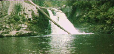
The trail to Abrams Falls is found at the far end of the Cades Cove Loop. It is well marked and well traveled. There are no spectacular views along this trail. It is moderate in length (about 5 miles round trip) and difficulty for the casual hiker. The trail follows the creek bottom through a rhododendron stand for a bit over a mile. It then diverges uphill in order to traverse the ridge to the right. There may be some laurel and azalea in isolated patches, but they are never over-abundant. Once you cross the gap in the ridge, your main uphill work is done (until you return!). There is an occasionally muddy run downhill for the last half mile or so before the falls. The falls itself is not particularly dramatic, however, they offer the largest volume of water over a falls in the park. The rocks along the shore are cool and large, which make for a nice picnic area, although often crowded. The sizeable island in the Creek, just to your right as you look at the falls, is a less populated picnic spot. But be careful wading across (or walking logs across) the creek; it's easy to slip. Fishing is a possibility here, although I would recommend the less crowded creek bottoms along the Little Bottoms Trail.