

View of Mount Mingus from an overlook on the trail to Alum Cave Bluff
Edye hiking to Alum Cave at Arch Rock.
The upper chimneys are visible from the overlook a couple of miles beyond
arch rock, as the lower ones hide behind the shoulder of Mt. LeConte.
Anakeesta Ridge rides above you to the left from the overlook.
<== Rhododendron canopy on the trail toward Alum Cave.
The way continues on beyond the shady evergreen arches, hugging the south
flank of Peregrine Peak. The trail is very steep for a few hundred feet
below the cave, which is about a half mile beyond the overlook. But do
continue up all the way to the 'cave', actually a cliff (and a popular hike
of which to boast). The view from the cave is just all right, but it is too
big a landmark not to visit, especially after making it this far! We found a
small trail continuing up the Bluff leading to the peak. Rain prevented us
from making it as of this writing.
The way on up to Mount LeConte is long, not terribly exciting and steep at
times. All cliff hugging is accompanied by sturdy cable handrails,
accommodating the novice hiker. The most impressive sight to me is probably
the aforementioned hole through the ridge. However, the rating as shortest
route to Mount LeConte is enough to attract crowds. The attire of hikers is
likely to change from blue jeans and tennis shoes to shorts, hiking boots,
packs and bandanas once you pass Alum Cave! I (Albert) still prefers tennis
shoes to hiking boots. (I think a pair of hiking boots is next to worthless
unless you plan to go places where rattlesnakes might be a problem. I have
yet to lay eyes on a pair of boots that could come close to the comfort of
tennis shoes. Just watch your feet and don't step on things which could hurt
you. Even on backpacking and night hikes I will wear them.)
We make the round trip to Alum Cave in about an hour and a half - a fairly
quick pace. The round trip time to Mount LeConte is impossible to estimate.
Before we were married Albert used to go it in two and a half hours round trip
running part way, but that's pretty fast. Three is a practical limit. Most
beginners walking briskly would average two miles per hour - that is five and
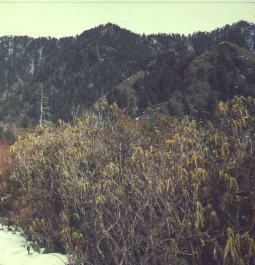
half hours plus stops, so BRING FOOD AND WATER. In winter, this is a VERY
icy, but beautiful pathway. Cable handrails are located along the worst
places - near Arch Rock and beyond Alum Cave enroute to LeConte.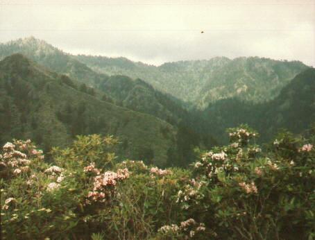


Leslie's notes: I hiked this trail to Mt. LeConte on my first visit to the
summit. It is not for the fainthearted or less than moderately fit. There
are lots of steep drop offs next to the trail, and I remember being glad
that I was prepared to meet my maker, in case I should fall off! While it
is the shortest trail in length, I think it is one of the hardest because
of the steepness. If you get too tired and have to make lots of rest
stops, you can use up the time you gained by it being a shorter trail.
>From the trailhead to arch rock seems long, but is fairly easy. After the
arch, the steepness picks up and the trail gets quite strenous after Alum
Cave. However, I would recommend taking another trail up, such as Trillium
Gap and coming down Alum Cave trail if you can arrange for someone to drive
your car from the trailhead of Trillium Gap to the start of Alum Cave
trail. It is the quickest way down, and that it a plus when you are tired
and hungry. However, if you have bad knees, it can be quite hard on them
coming down a very steep trail.
Return to Smoky Mountain Home Page.